| ||||||
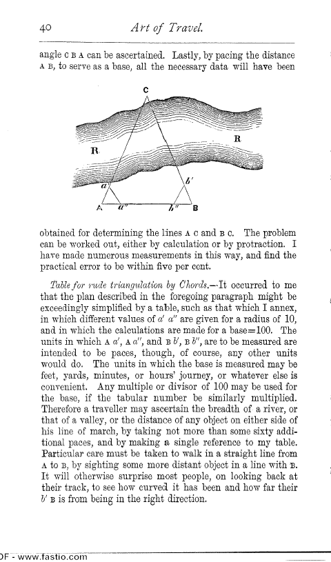
OCR Rendition - approximate40 A Pt of Travel. angle c B A can be ascertained. Lastly, by pacing the distance A B, to serve as a base, all the necessary data will have been C obtained for determining the lines A c and B c. The problem can be worked out, either by calculation or by protraction. I have made numerous measurements in this way, and find the practical error to be within five per cent. Table for rude triangulation by Chords.--It occurred to me that the plan described in the foregoing paragraph might be exceedingly simplified by a table, such as that which I annex, in which different values of a' a" are given for a radius of 10, and in which the calculations are made for a base=100. The units in which A a', A a", and B b', B b", are to be measured are intended to be paces, though, of course, any other units would do. The units in which the base is measured may be feet, yards, minutes, or hours' journey, or whatever else is convenient. Any multiple or divisor of 100 may be used for the base, if the tabular number be similarly multiplied. Therefore a traveller may ascertain the breadth of a river, or that of a valley, or the distance of any object on either side of his line of march, by taking not more than some sixty additional paces, and by making a single reference to my table. Particular care must be taken to walk in a straight line from A to B, by sighting some more distant object in a line with m. It will otherwise surprise most people, on looking back at their track, to see how curved it has been and how far their b' B is from being in the right direction. )F - www.fastio.com |